


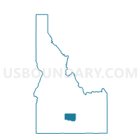
Voting District 063005, Lincoln County, Idaho
About
Outline

Summary
| Unique Area Identifier | 564262 |
| Name | Voting District 063005 |
| County | Lincoln County |
| State | Idaho |
| Area (square miles) | 155.25 |
| Land Area (square miles) | 154.83 |
| Water Area (square miles) | 0.42 |
| % of Land Area | 99.73 |
| % of Water Area | 0.27 |
| Latitude of the Internal Point | 42.88378450 |
| Longtitude of the Internal Point | -114.18708930 |
Maps


Graphs
Select a template below for downloading or customizing gragh for Voting District 063005, Lincoln County, Idaho


Neighbors
Neighoring Voting District (by Name) Neighboring Voting District on the Map
- Voting District 063001, Lincoln County, ID
- Voting District 063002, Lincoln County, ID
- Voting District 063004, Lincoln County, ID
- Voting District 063006, Lincoln County, ID
- Hazelton Voting District, Jerome County, ID
- Shepherd Voting District, Jerome County, ID
Top 10 Neighboring County Subdivision (by Population) Neighboring County Subdivision on the Map
- Shoshone CCD, Lincoln County, ID (4,059)
- Richfield CCD, Lincoln County, ID (1,149)
- Hunt CCD, Jerome County, ID (520)
Top 10 Neighboring Place (by Population) Neighboring Place on the Map
Top 10 Neighboring Unified School District (by Population) Neighboring Unified School District on the Map
- Jerome Joint School District 261, ID (19,389)
- Shoshone Joint School District 312, ID (3,128)
- Richfield School District 316, ID (1,055)
- Dietrich School District 314, ID (816)